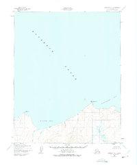
1950 Map of Kotzebue A-1
USGS Topo · Published 1975About this map
Kotzebue Sound dominates the northern expanse of this 1950 coastal study, where the waters meet the indented shoreline of the Baldwin Peninsula. The survey reveals a landscape defined by drainage patterns and coastal landmarks, stretching from Ninemile Pt in the west across the curve of Willow Bay to the prominent Motherwood Pt. This era of mapping, based on 1950 aerial photography with revisions in the early 1970s, captures the isolation of the region before significant modern development. A lone Cabin and several triangulation stations like VABM Mother and VABM Will serve as the primary human identifiers in an area otherwise characterized by its network of coastal streams. Numerous waterways, including Hunter Creek, Alder Creek, and Kirk Creek, flow into Spafarief Bay, illustrating the complex hydrological drainage into the sound.
Find a feature on this map
13 named features on this map. Tap any name to fly to it.
Don’t see what you’re looking for? This feature index may not catch every label — zoom into the map to look around manually.
Map Details
Editions of this 1950 Kotzebue A-1 Map
3 editions found
Other maps of this area

1950 · Kotzebue A-1
USGS Topo · 1:63,360

1950 · Bendeleben D-2
USGS Topo · 1:63,360

1950 · Bendeleben
USGS Topo · 1:250,000

1950 · Bendeleben D-1
USGS Topo · 1:63,360

1950 · Kotzebue A-2
USGS Topo · 1:63,360

1951 · Candle
USGS Topo · 1:250,000

1951 · Selawik
USGS Topo · 1:250,000

1951 · Bendeleben
USGS Topo · 1:250,000

1951 · Kotzebue
USGS Topo · 1:250,000

1951 · Selawik B-6
USGS Topo · 1:63,360