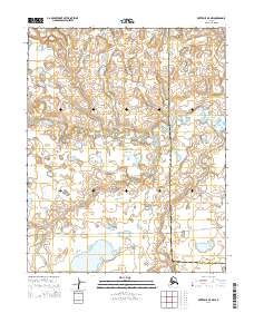
2014 Map of Kotzebue A-5 NW
USGS Topo · Published 2014About this map
The Bering Land Bridge National Preserve dominates this remote Arctic landscape, representing a critical area for understanding the ancient migration corridor between Asia and North America. This 2014 survey documents a vast expanse of tundra and wetlands within the Nome Census Area and the Northwest Arctic Borough. The hydrology is defined by the winding paths of the Nugnugaluktuk River in the north and the Lane River to the south. Human presence is sparse, marked primarily by the Lane River Road and the Me_unassigned_lane River Road, which cut through the southern sections of the quadrangle. The map illustrates the complex network of thaw lakes and drainages characteristic of this permafrost-underlain region, providing a detailed record of the terrain as it existed in the early 21st century.
Find a feature on this map
13 named features on this map. Tap any name to fly to it.
Don’t see what you’re looking for? This feature index may not catch every label — zoom into the map to look around manually.
Map Details
Editions of this 2014 Kotzebue A-5 NW Map
This is the sole edition of this map. No revisions or reprints were ever made.
Other maps of this area

1950 · Kotzebue A-6
USGS Topo · 1:63,360

1950 · Kotzebue B-5
USGS Topo · 1:63,360

1950 · Kotzebue B-6
USGS Topo · 1:63,360

1950 · Kotzebue A-5
USGS Topo · 1:63,360

1951 · Kotzebue
USGS Topo · 1:250,000

1958 · Kotzebue
USGS Topo · 1:250,000

1964 · Kotzebue
USGS Topo · 1:250,000
2014 · Kotzebue A-5 SE
USGS Topo · 1:25,000
2014 · Kotzebue A-6 SE
USGS Topo · 1:25,000
2014 · Kotzebue A-5 SW
USGS Topo · 1:25,000