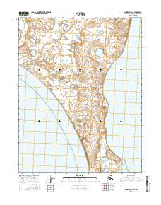
2016 Map of Kotzebue C-1 NE
USGS Topo · Published 2016About this map
The Baldwin Peninsula forms the backbone of this coastal landscape, separating the open waters of the Kotzebue Sound to the west from the more sheltered Hotham Inlet to the east. This 2016 survey illustrates the intricate network of wetlands and small coastal water bodies that dominate the northern reaches of the peninsula above the Arctic Circle. The terrain is characterized by low-lying elevations and a complex hydrography, typical of the Northwest Arctic's delicate shoreline ecosystems. Without any recorded roads or permanent settlements in this specific quadrangle, the map serves as a detailed record of the natural topography and coastal boundaries as they existed in the early 21st century, providing essential data for studying Arctic shoreline changes and public land survey divisions.
Find a feature on this map
11 named features on this map. Tap any name to fly to it.
Don’t see what you’re looking for? This feature index may not catch every label — zoom into the map to look around manually.
Map Details
Editions of this 2016 Kotzebue C-1 NE Map
This is the sole edition of this map. No revisions or reprints were ever made.
Other maps of this area

1951 · Selawik
USGS Topo · 1:250,000

1951 · Kotzebue
USGS Topo · 1:250,000

1951 · Kotzebue D-1
USGS Topo · 1:63,360

1951 · Selawik C-6
USGS Topo · 1:63,360

1951 · Selawik D-6
USGS Topo · 1:63,360
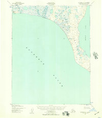
1951 · Kotzebue C-1
USGS Topo · 1:63,360

1952 · Selawik D-6
USGS Topo · 1:63,360

1957 · Selawik
USGS Topo · 1:250,000

1958 · Kotzebue
USGS Topo · 1:250,000

1964 · Kotzebue
USGS Topo · 1:250,000