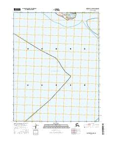
2016 Map of Kotzebue D-2 NW
USGS Topo · Published 2016About this map
Cape Krusenstern National Monument occupies the northern coastal reaches of this map, representing a significant protected landscape on the shores of the Chukchi Sea. This area is defined by the narrow Sheshalik Spit, a coastal landform that separates the open waters from the interior lagoons and serves as the site for the settlement of Sheshalik. Historically, this location has been a seasonal hub for subsistence activities, strategically positioned where the land meets the expansive Kotzebue Sound. The map reveals the intricate shoreline of the Alaska Northwest Arctic Borough, illustrating the delicate balance of coastal geography in this high-latitude environment before further modern shifts in the Arctic coastline.
Find a feature on this map
5 named features on this map. Tap any name to fly to it.
Don’t see what you’re looking for? This feature index may not catch every label — zoom into the map to look around manually.
Map Details
Editions of this 2016 Kotzebue D-2 NW Map
This is the sole edition of this map. No revisions or reprints were ever made.
Other maps of this area

1951 · Noatak
USGS Topo · 1:250,000

1951 · Kotzebue
USGS Topo · 1:250,000

1951 · Kotzebue D-2
USGS Topo · 1:63,360

1952 · Noatak A-3
USGS Topo · 1:63,360

1955 · Noatak
USGS Topo · 1:250,000
1955 · Noatak A-2
USGS Topo · 1:63,360

1958 · Kotzebue
USGS Topo · 1:250,000

1964 · Noatak
USGS Topo · 1:250,000

1964 · Kotzebue
USGS Topo · 1:250,000
2016 · Noatak A-2 SW
USGS Topo · 1:25,000