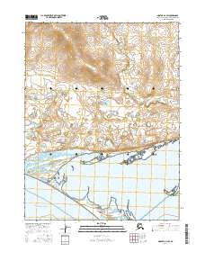
2016 Map of Noatak A-2 SW
USGS Topo · Published 2016About this map
Cape Krusenstern National Monument dominates this arctic coastal landscape, where the northernmost reaches of the Seward Peninsula meet the Chukchi Sea. The map highlights the shifting geomorphology of the shoreline, specifically the elongated Sheshalik Spit which acts as a natural barrier for the waters of Kotzebue Sound. This transition zone between the marine environment and the interior tundra is characterized by a complex network of seasonal wetlands and small ponds, reflecting the permafrost-driven hydrology of the region. The grid of the public land survey system, including townships t20n r19w and t19n r20w, provides a sparse human overlay on a terrain primarily defined by natural coastal processes and federally protected lands.
Find a feature on this map
7 named features on this map. Tap any name to fly to it.
Don’t see what you’re looking for? This feature index may not catch every label — zoom into the map to look around manually.
Map Details
Editions of this 2016 Noatak A-2 SW Map
This is the sole edition of this map. No revisions or reprints were ever made.
Other maps of this area

1951 · Noatak
USGS Topo · 1:250,000

1951 · Kotzebue
USGS Topo · 1:250,000

1951 · Kotzebue D-2
USGS Topo · 1:63,360

1952 · Noatak A-3
USGS Topo · 1:63,360

1955 · Noatak
USGS Topo · 1:250,000
1955 · Noatak A-2
USGS Topo · 1:63,360

1958 · Kotzebue
USGS Topo · 1:250,000

1964 · Noatak
USGS Topo · 1:250,000

1964 · Kotzebue
USGS Topo · 1:250,000
2015 · Noatak A-3 NE
USGS Topo · 1:25,000