
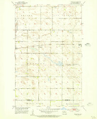
1949 Map of Kramer
USGS Topo · Published 1976About this map
Kramer serves as the central hub of this North Dakota landscape, situated at the junction of the Minneapolis St Paul and Sault Ste Marie railroad lines. The area is defined by a systematic grid of section lines, where rural life is anchored by localized institutions like School No 1, Thrums Sch No 4, and Mouse River Sch No 3. To the south, the terrain shifts into the managed wetlands of the J Clark Salyer National Wildlife Refuge, where the Souris River (also labeled here as the Mouse River) meanders through the Bottineau and McHenry county line.
Find a feature on this map
21 named features on this map. Tap any name to fly to it.
Don’t see what you’re looking for? This feature index may not catch every label — zoom into the map to look around manually.
Map Details
Editions of this 1949 Kramer Map
This is the sole edition of this map. No revisions or reprints were ever made.
Other maps of this area

1950 · Kramer
USGS Topo · 1:24,000

1950 · Upham SE
USGS Topo · 1:24,000

1950 · Deep
USGS Topo · 1:24,000

1950 · Upham
USGS Topo · 1:24,000

1950 · Newburg SE
USGS Topo · 1:24,000

1954 · Souris SW
USGS Topo · 1:24,000

1954 · Landa SE
USGS Topo · 1:24,000

1954 · Souris SE
USGS Topo · 1:24,000

1954 · Minot
USGS Topo · 1:250,000
1955 · Upham NE
USGS Topo · 1:24,000