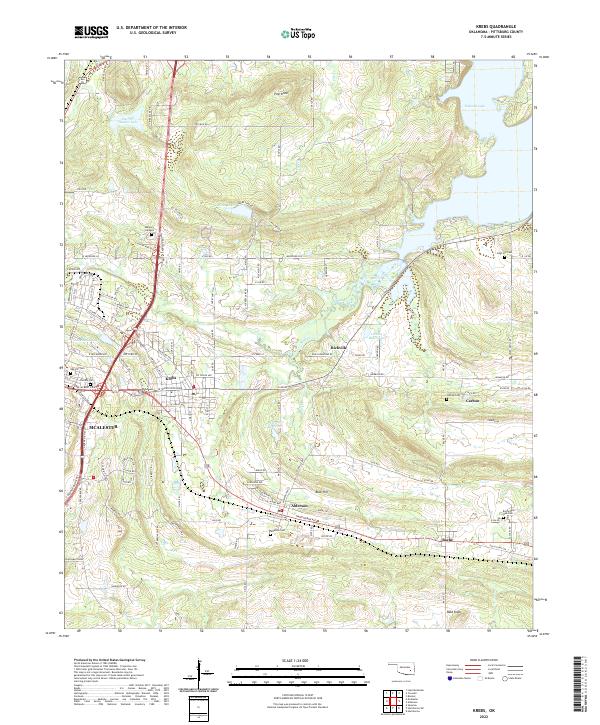
2022 Map of Krebs
USGS Topo · Published 2022About this map
Krebs and the surrounding coal-country communities of Alderson, Bache, and Carbon are meticulously detailed in this contemporary look at Pittsburg County. The landscape is defined by its industrial and social legacy, with numerous cemeteries such as Oak Hill Cem, Calvary Cem, and Bache Red Oak Cem anchoring the historical geography of these settlements. The presence of McAlester on the western edge highlights the regional urban shift, while the eastern terrain transitions into the fingers of Eufaula Lake. High ground like Pine Knob and Buck Hill overlook a network of creek drainages including Mud Creek and Black Cr. The map captures the current state of a region where historic mining hamlets have evolved into residential corridors, connected by rural routes like Old Town Rd and Defrange Dr.
Find a feature on this map
124 named features on this map. Tap any name to fly to it.
Don’t see what you’re looking for? This feature index may not catch every label — zoom into the map to look around manually.
Map Details
Editions of this 2022 Krebs Map
This is the sole edition of this map. No revisions or reprints were ever made.
Other maps of this area

1898 · McAlester
USGS Topo · 1:125,000

1900 · Canadian
USGS Topo · 1:125,000

1909 · Mc Alester
USGS Topo · 1:125,000

1946 · Fort Smith
USGS Topo · 1:250,000

1950 · Mcalester
USGS Topo · 1:250,000

1962 · McAlester
USGS Topo · 1:250,000

1965 · Fort Smith
USGS Topo · 1:250,000

1965 · McAlester
USGS Topo · 1:250,000

1967 · Fort Smith
USGS Topo · 1:250,000

1967 · Krebs
USGS Topo · 1:24,000