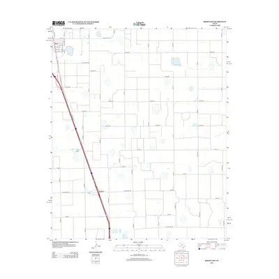
2012 Map of Kress East
USGS Topo · Published 2012About this map
Kress serves as the primary hub of this High Plains landscape, where the grid of town streets like N Hurson Ave and S Caldwell Ave meets the expansive agricultural section lines of Swisher County. The map captures a highly organized rural infrastructure, dominated by a geometric network of county roads such as Co Road AA and Co Road BB. A significant interpretive detail is the presence of Old Cemetery Rd, which points to the long-standing community roots and early settlement patterns of the area. To the south, the small community of Finney sits along the primary transport corridor, illustrating how local life and commerce were historically tied to the highway and ranch roads like Ranch Road 145 and Ranch Road 788 that cut across the prairie.
Find a feature on this map
38 named features on this map. Tap any name to fly to it.
Don’t see what you’re looking for? This feature index may not catch every label — zoom into the map to look around manually.
Map Details
Editions of this 2012 Kress East Map
This is the sole edition of this map. No revisions or reprints were ever made.
Other maps of this area

1954 · Plainview
USGS Topo · 1:250,000

1958 · Plainview
USGS Topo · 1:250,000

1965 · Edmonson NE
USGS Topo · 1:24,000

1965 · Kress West
USGS Topo · 1:24,000

1965 · Wasson
USGS Topo · 1:24,000

1965 · Plainview
USGS Topo · 1:24,000

1968 · Aiken
USGS Topo · 1:24,000

1969 · Kress East
USGS Topo · 1:24,000

1969 · Claytonville
USGS Topo · 1:24,000

1969 · Claytonville NW
USGS Topo · 1:24,000