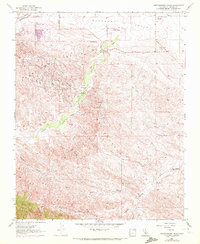
1956 Map of Kreyenhagen Hills
USGS Topo · Published 1972About this map
Pleasant Valley and the surrounding ridgelines define this section of Fresno County, where industrial development meets traditional ranching operations. The Coalinga Oil Field dominates the northwest, evidenced by numerous gas and oil wells, tanks, and a collection of sumps concentrated near Jacalitos Creek. This industrial footprint contrasts with the scattered family-named outposts such as Zuburi Ranch and Johnson Ranch, which are situated along the valley floor near a Cotton Gin and grain storage facilities.
Find a feature on this map
31 named features on this map. Tap any name to fly to it.
Don’t see what you’re looking for? This feature index may not catch every label — zoom into the map to look around manually.
Map Details
Editions of this 1956 Kreyenhagen Hills Map
3 editions found
Other maps of this area

1912 · Coalinga
USGS Topo · 1:125,000

1914 · Cholame
USGS Topo · 1:125,000

1915 · Cholame
USGS Topo · 1:125,000

1917 · Cholame
USGS Topo · 1:125,000

1930 · Canoas Creek
USGS Topo · 1:31,680

1933 · Guijarral Hills
USGS Topo · 1:31,680

1934 · The Dark Hole
USGS Topo · 1:31,680

1934 · Reef Ridge
USGS Topo · 1:31,680

1934 · Canoas Creek
USGS Topo · 1:31,680

1936 · Kreyenhagen Hills
USGS Topo · 1:31,680