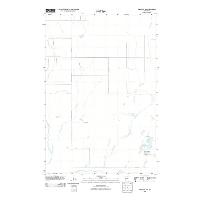
2010 Map of Kroschel NW
USGS Topo · Published 2010About this map
The Snake River meanders through the western portion of this Kanabec County landscape, defining the character of a region dominated by riparian corridors and managed conservation lands. Significant protection for local ecosystems is evident at the Lake Five State Wildlife Management Area in the southeast, which encompasses both Lake Five and Long Lake. This area provides a specialized look at the hydrology of the North Woods, where Chelsey Brook and Cowans Brook provide essential drainage across a grid of rural routes.
Find a feature on this map
29 named features on this map. Tap any name to fly to it.
Don’t see what you’re looking for? This feature index may not catch every label — zoom into the map to look around manually.
Map Details
Editions of this 2010 Kroschel NW Map
This is the sole edition of this map. No revisions or reprints were ever made.
Other maps of this area

1953 · Duluth
USGS Topo · 1:250,000

1958 · Duluth
USGS Topo · 1:250,000

1968 · Kroschel NW
USGS Topo · 1:24,000

1968 · Pomroy Lake
USGS Topo · 1:24,000

1968 · Warman
USGS Topo · 1:24,000

1968 · Giese
USGS Topo · 1:24,000
1968 · Kroschel
USGS Topo · 1:24,000

1968 · Mc Grath
USGS Topo · 1:24,000

1969 · Solana
USGS Topo · 1:24,000

1969 · Arthyde
USGS Topo · 1:24,000