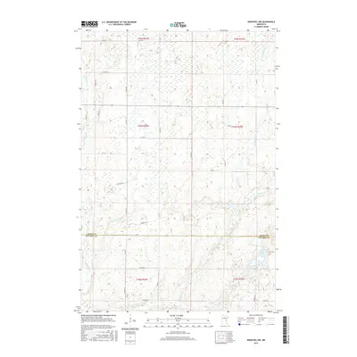
2016 Map of Kroschel NW
USGS Topo · Published 2016About this map
The Snake River winds through the western reaches of this section of Minnesota, marking a landscape defined by its glacial hydrology and dense network of rural arteries. Located along the jurisdictional boundary of Aitkin Co Kanabec Co, the terrain is heavily marked by wetlands and small drainages such as Cowans Brook and Chelsey Brook. The road network follows the rigid grid of the Public Land Survey System, with numerous local connectors like Whalen Rd and Aleta Trl providing access to secluded water bodies like Lake Five and Long Lake. This 2016 survey illustrates the persistent rural character of the region, where historical naming conventions for roads such as Loging Rd hint at the area's industrial past and the continuing importance of timber and natural resource management in this part of the North Woods.
Find a feature on this map
36 named features on this map. Tap any name to fly to it.
Don’t see what you’re looking for? This feature index may not catch every label — zoom into the map to look around manually.
Map Details
Editions of this 2016 Kroschel NW Map
This is the sole edition of this map. No revisions or reprints were ever made.
Other maps of this area

1953 · Duluth
USGS Topo · 1:250,000

1958 · Duluth
USGS Topo · 1:250,000

1968 · Kroschel NW
USGS Topo · 1:24,000

1968 · Pomroy Lake
USGS Topo · 1:24,000

1968 · Warman
USGS Topo · 1:24,000

1968 · Giese
USGS Topo · 1:24,000
1968 · Kroschel
USGS Topo · 1:24,000

1968 · Mc Grath
USGS Topo · 1:24,000

1969 · Solana
USGS Topo · 1:24,000

1969 · Arthyde
USGS Topo · 1:24,000