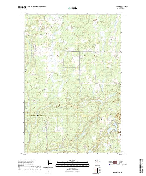
2022 Map of Kroschel NW
USGS Topo · Published 2022About this map
Snake River and its various tributaries define the hydrology of this Aitkin County landscape, where wetland systems and low-lying drainage basins dominate the terrain. The map records a complex network of rural infrastructure, from established county routes like Co Rd 61 to more specialized pathways such as Loging Rd and the Snake River Trl. These routes navigate a mosaic of public and private land boundaries that straddle the Aitkin Co Kanabec Co line.
Find a feature on this map
37 named features on this map. Tap any name to fly to it.
Don’t see what you’re looking for? This feature index may not catch every label — zoom into the map to look around manually.
Map Details
Editions of this 2022 Kroschel NW Map
This is the sole edition of this map. No revisions or reprints were ever made.
Other maps of this area

1953 · Duluth
USGS Topo · 1:250,000

1958 · Duluth
USGS Topo · 1:250,000

1968 · Kroschel NW
USGS Topo · 1:24,000

1968 · Pomroy Lake
USGS Topo · 1:24,000

1968 · Warman
USGS Topo · 1:24,000

1968 · Giese
USGS Topo · 1:24,000
1968 · Kroschel
USGS Topo · 1:24,000

1968 · Mc Grath
USGS Topo · 1:24,000

1969 · Solana
USGS Topo · 1:24,000

1969 · Arthyde
USGS Topo · 1:24,000