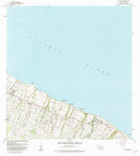
1982 Map of Kukaiau
USGS Topo · Published 1984About this map
Paauilo and Kukaiau anchor this coastal segment of the Hamakua Coast, where the island's steep volcanic slopes meet the Pacific Ocean. This early 1980s data illustrates the dense arrangement of agricultural land and residential clusters that defined the region's economy, specifically seen in the Paauilo Homesteads and Kainehe Homesteads. The terrain is defined by a series of deep gulches, including Kainehe Gulch and Kaala Stream, which carve through the land toward the sea.
Find a feature on this map
58 named features on this map. Tap any name to fly to it.
Don’t see what you’re looking for? This feature index may not catch every label — zoom into the map to look around manually.
Map Details
Editions of this 1982 Kukaiau Map
2 editions found
Other maps of this area

1915 · Hamakua
USGS Topo · 1:62,500

1915 · Honomu
USGS Topo · 1:62,500

1954 · Hawaii North
USGS Topo · 1:250,000

1956 · Keanakolu
USGS Topo · 1:24,000

1956 · Umikoa
USGS Topo · 1:24,000

1957 · Kukaiau
USGS Topo · 1:24,000

1957 · Honokaa
USGS Topo · 1:24,000

1959 · Hawaii North
USGS Topo · 1:250,000

1961 · Hawaii North
USGS Topo · 1:250,000
1966 · Papaaloa
USGS Topo · 1:24,000