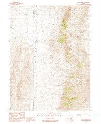
1990 Map of Kumiva Peak
USGS Topo · Published 1990About this map
The Selenite Range dominates this Great Basin landscape, rising sharply above the desert floor at the border of Washoe and Pershing counties. In this 1990 provisional survey, the high peaks of Kumiva Peak and Luxor Peak define the eastern ridge, while the vast Poito Valley stretches across the western half of the sheet. Human presence is sparse and focused on ranching and resource extraction, evidenced by the Cowles Ranch and a scattered Corral. The terrain is marked by numerous prospects and a Borrow Pit, indicating the area's history of mineral exploration. Water is a critical and infrequent feature, found at scattered Springs and along ephemeral drainages like Little Meadow Creek, Jenny Creek, and Little Jenny Creek. A single Trail provides access through the rugged canyons of the range, highlighting the isolation of this Nevada backcountry.
Find a feature on this map
17 named features on this map. Tap any name to fly to it.
Don’t see what you’re looking for? This feature index may not catch every label — zoom into the map to look around manually.
Map Details
Editions of this 1990 Kumiva Peak Map
This is the sole edition of this map. No revisions or reprints were ever made.
Other maps of this area

1886 · Granite Range
USGS Topo · 1:250,000

1894 · Granite Range
USGS Topo · 1:250,000

1955 · Lovelock
USGS Topo · 1:250,000

1959 · Lovelock
USGS Topo · 1:250,000

1964 · Gerlach
USGS Topo · 1:62,500

1964 · Kumiva Peak
USGS Topo · 1:62,500

1980 · Tenmile
USGS Topo · 1:24,000

1981 · Gerlach
USGS Topo · 1:100,000
1981 · Betty Creek
USGS Topo · 1:24,000
1981 · Jayhawk Well
USGS Topo · 1:24,000