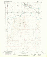
1958 Map of Kuna
USGS Topo · Published 1972About this map
The town of Kuna serves as the central hub on this mid-century survey, positioned along the Union Pacific Railroad (Oregon Short Line). The landscape is defined by the intersection of natural drainage and an extensive irrigation network, including the New York Canal, Kuna Canal, and Mora Canal, which turned this arid Snake River Plain region into productive agricultural land. To the south, the prominent volcanic profile of Kuna Butte rises above the surrounding fields, a landmark for the area alongside the nearby Kuna Cave. This edition also captures localized industrial activity such as the Cinder Pit and several gravel pits, which provided materials for the growing regional infrastructure. Tracing the boundary between Canyon County and Ada County, the map records the rural road network including Bennett Road and Bowmont Road, marking the transition from established farms to the undeveloped terrain surrounding the butte.
Find a feature on this map
21 named features on this map. Tap any name to fly to it.
Don’t see what you’re looking for? This feature index may not catch every label — zoom into the map to look around manually.
Map Details
Editions of this 1958 Kuna Map
3 editions found
Other maps of this area

1892 · Boise
USGS Topo · 1:125,000

1892 · Bisuka
USGS Topo · 1:125,000

1892 · Silver City
USGS Topo · 1:125,000

1894 · Bisuka
USGS Topo · 1:125,000

1894 · Silver City
USGS Topo · 1:125,000

1897 · Boise
USGS Topo · 1:125,000

1898 · Nampa
USGS Topo · 1:125,000

1898 · Silver City
USGS Topo · 1:125,000

1953 · Cloverdale
USGS Topo · 1:24,000

1953 · Meridian
USGS Topo · 1:24,000