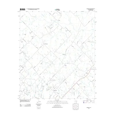
2013 Map of Kurten
USGS Topo · Published 2013About this map
Kurten and Wixon Valley anchor this portion of Brazos County, where the landscape is defined by the headwaters and tributaries of several prominent creeks. The drainage patterns of Wickson Cr, Bee Cr, and Sand Cr dictate the layout of the local road network, which connects scattered rural settlements such as Cottonwood, Tabor, and Union. This area is particularly notable for its dense concentration of family and community burial grounds, including the Schultze Cem, Evans Cem, and Fridel Cem, suggesting a long-established pattern of small-plot land ownership and localized heritage. Evidence of past community infrastructure remains visible through names like J M Moore Schoolhouse Rd, marking the site of former local institutions. The terrain transitions from the open flats of String Prairie to the wooded draws of Ferrill Br and Mathis Cr, illustrating the typical ecological variation of the east-central Texas interior.
Find a feature on this map
94 named features on this map. Tap any name to fly to it.
Don’t see what you’re looking for? This feature index may not catch every label — zoom into the map to look around manually.
Map Details
Editions of this 2013 Kurten Map
This is the sole edition of this map. No revisions or reprints were ever made.
Other maps of this area

1925 · Iola No 2
USGS Topo · 1:48,000

1931 · Iola
USGS Topo · 1:62,500

1954 · Austin
USGS Topo · 1:250,000

1956 · Bryan
USGS Topo · 1:62,500

1956 · Carlos
USGS Topo · 1:62,500

1959 · Clear Lake
USGS Topo · 1:24,000

1959 · Reliance
USGS Topo · 1:24,000

1962 · Edge
USGS Topo · 1:24,000

1962 · Wheelock
USGS Topo · 1:24,000

1962 · Bryan East
USGS Topo · 1:24,000