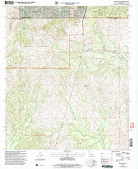
2003 Map of Kurthwood
USGS Topo · Published 2005About this map
The Fort Polk Military Reservation dominates the western landscape of this Central Louisiana territory, where the Peason Ridge Artillery Range meets the timberlands of the Kisatchie National Forest. This intersection of military training grounds and managed forest creates a distinct rural character, centered around the small settlement of Kurthwood. The geography is defined by the headwaters and branches of the Calcasieu River, which meanders through the southern portion of the sheet. Local life is anchored by several country congregations, including Kurthwood Ch and Sunny Hill Ch, alongside the West Cem. The presence of the Kurthwood Fire Tower underscores the region's historical reliance on forest management and lookout infrastructure. Smaller communities like Fisherville and Dusenbury dot the eastern edge, connected by a network of creeks such as Comrade Creek and Baygall Branch.
Find a feature on this map
31 named features on this map. Tap any name to fly to it.
Don’t see what you’re looking for? This feature index may not catch every label — zoom into the map to look around manually.
Map Details
Editions of this 2003 Kurthwood Map
This is the sole edition of this map. No revisions or reprints were ever made.
Other maps of this area

1941 · Leesville
USGS Topo · 1:62,500

1941 · Slagle
USGS Topo · 1:62,500

1942 · Florien
USGS Topo · 1:62,500

1942 · Kisatchie
USGS Topo · 1:62,500

1943 · Leesville
USGS Topo · 1:62,500

1943 · Kisatchie
USGS Topo · 1:62,500

1944 · Florien
USGS Topo · 1:62,500

1944 · Slagle
USGS Topo · 1:62,500

1946 · Leesville
USGS Topo · 1:62,500

1948 · Leesville
USGS Topo · 1:62,500