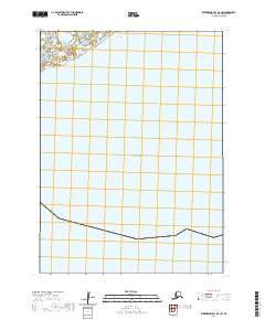
2020 Map of Kuskokwim Bay D-3 SW
USGS Topo · Published 2020About this map
Bering Sea waters dominate this coastal perspective within the Bethel Census Area, reflecting the maritime environment of southwestern Alaska. The map focuses on the vast expanse where the coastal shelf meets the open ocean, articulated through detailed bathymetric and grid data. While primarily a marine study, the northern reaches capture the transition into the tidal wetlands and marshy coastal plains typical of the region. This 2020 edition provides a clear picture of the modern coastline before further environmental shifts, following the Public Land Survey System through townships t3s r81w, t3s r80w, t4s r81w, and t4s r80w.
Find a feature on this map
5 named features on this map. Tap any name to fly to it.
Don’t see what you’re looking for? This feature index may not catch every label — zoom into the map to look around manually.
Map Details
Editions of this 2020 Kuskokwim Bay D-3 SW Map
This is the sole edition of this map. No revisions or reprints were ever made.
Other maps of this area

1951 · Kuskokwim Bay
USGS Topo · 1:250,000

1954 · Kuskokwim Bay
USGS Topo · 1:250,000
1954 · Kuskokwim Bay D-4
USGS Topo · 1:63,360
1954 · Kuskokwim Bay D-3
USGS Topo · 1:63,360
2018 · Kuskokwim Bay D-3 NE
USGS Topo · 1:25,000
2020 · Kuskokwim Bay D-3 NW
USGS Topo · 1:25,000
2020 · Kuskokwim Bay D-4 NE
USGS Topo · 1:25,000
2020 · Kuskokwim Bay D-4 SE
USGS Topo · 1:25,000