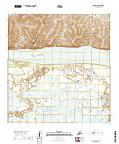
2020 Map of Kwiguk A-4 SE
USGS Topo · Published 2020About this map
Mountain Village sits on the northern bank of the Yukon River, serving as a focal point of this Kusilvak landscape. The village's local geography is defined by the elevation of Azachorok Hill and a street network including Peterson Street and Valley Street. Transportation in and out of this remote community relies on the Mountain Village Airport and the Saint Marys/Mountain Village Road, which traverses the higher ground above the river's floodplain.
Find a feature on this map
16 named features on this map. Tap any name to fly to it.
Don’t see what you’re looking for? This feature index may not catch every label — zoom into the map to look around manually.
Map Details
Editions of this 2020 Kwiguk A-4 SE Map
This is the sole edition of this map. No revisions or reprints were ever made.
Other maps of this area

1951 · Marshall
USGS Topo · 1:250,000

1952 · Kwiguk
USGS Topo · 1:250,000

1952 · Kwiguk A-4
USGS Topo · 1:63,360

1952 · Kwiguk A-3
USGS Topo · 1:63,360

1952 · Marshall D-5
USGS Topo · 1:63,360

1952 · Marshall D-4
USGS Topo · 1:63,360

1954 · Marshall
USGS Topo · 1:250,000
2020 · Marshall D-4 NW
USGS Topo · 1:25,000
2020 · Marshall D-5 NE
USGS Topo · 1:25,000
2020 · Kwiguk A-3 SW
USGS Topo · 1:25,000