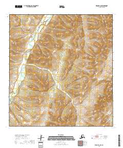
2018 Map of Kwiguk C-1 NW
USGS Topo · Published 2018About this map
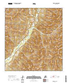
The Andreafsky River meanders through the western portion of this landscape, carving a valley through the complex topography of the Nulato Hills. In the north, the river is characterized by tight oxbows and a narrow flood plain, while moving southward it transitions into a broader marshy corridor marked by numerous small wetlands and drainage channels. This 2018 survey reveals a terrain defined by significant elevation changes, where the high ridges of the Nulato Hills drop toward the alluvial basin. The lack of named settlements or infrastructure highlights the wild, undeveloped nature of this corner of the Kusilvak Census Area, where the natural hydrologic and geologic patterns of the Alaskan interior remain the primary features of interest.
Find a feature on this map
9 named features on this map. Tap any name to fly to it.
Don’t see what you’re looking for? This feature index may not catch every label — zoom into the map to look around manually.
Map Details
Editions of this 2018 Kwiguk C-1 NW Map
This is the sole edition of this map. No revisions or reprints were ever made.
Other maps of this area

1952 · Kwiguk
USGS Topo · 1:250,000

1952 · Kwiguk D-1
USGS Topo · 1:63,360

1952 · Kwiguk C-2
USGS Topo · 1:63,360

1952 · Kwiguk D-2
USGS Topo · 1:63,360

1952 · Kwiguk C-1
USGS Topo · 1:63,360
2018 · Kwiguk D-1 SW
USGS Topo · 1:25,000
2018 · Kwiguk C-2 SE
USGS Topo · 1:25,000
2018 · Kwiguk C-2 NE
USGS Topo · 1:25,000
2018 · Kwiguk C-1 SE
USGS Topo · 1:25,000
2018 · Kwiguk D-1 SE
USGS Topo · 1:25,000