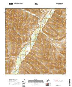
2018 Map of Kwiguk C-2 SE
USGS Topo · Published 2018About this map
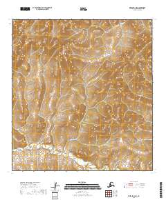
The Andreafsky River winds through this terrain within the Kusilvak Census Area, serving as the primary geographical marker of this subarctic landscape. This 2018 survey reveals a territory defined by intricate elevation changes and extensive wetland systems, documented through hydrography data spanning 2002 to 2017. The absence of road infrastructure or named settlements on the map underscores the isolation of this region, where the river serves as the dominant natural corridor. Land management is delineated by several township and range boundaries, including t29n r72w, t29n r71w, and t28n r72w. These survey lines, provided by the Bureau of Land Management, represent the primary human imprint on a landscape otherwise characterized by natural drainages and complex topography.
Find a feature on this map
6 named features on this map. Tap any name to fly to it.
Don’t see what you’re looking for? This feature index may not catch every label — zoom into the map to look around manually.
Map Details
Editions of this 2018 Kwiguk C-2 SE Map
This is the sole edition of this map. No revisions or reprints were ever made.
Other maps of this area

1952 · Kwiguk
USGS Topo · 1:250,000

1952 · Kwiguk B-2
USGS Topo · 1:63,360

1952 · Kwiguk C-2
USGS Topo · 1:63,360

1952 · Kwiguk B-1
USGS Topo · 1:63,360

1952 · Kwiguk C-1
USGS Topo · 1:63,360
2018 · Kwiguk C-1 NW
USGS Topo · 1:25,000
2018 · Kwiguk C-2 NE
USGS Topo · 1:25,000
2018 · Kwiguk C-2 NW
USGS Topo · 1:25,000
2018 · Kwiguk C-2 SW
USGS Topo · 1:25,000
2018 · Kwiguk B-1 NW
USGS Topo · 1:25,000