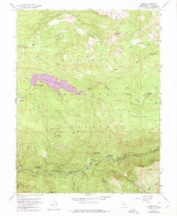
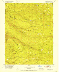
1952 Map of Kyburz
USGS Topo · Published 1975About this map
Kyburz sits along the South Fork American River in this mid-century topographic survey of the Eldorado National Forest. The map documents a landscape transitioning toward recreational use while maintaining its remote ranching and forestry roots. Purple revisions from 1973 highlight the significant impact of the Ice House Reservoir, which altered the drainage of the South Fork Silver Creek. Evidence of early settlement and land use is found at Jones Place, Wilson Ranch, and the Windmiller Cabin, while local education is represented by the Silver Fork School near the river. Topographic landmarks like Sugarloaf and Eagle Rock overlook a network of seasonal watercourses, including Peavine Creek and Lyons Creek, alongside infrastructure like the Windmiller Trail and various gaging stations used for water management.
Find a feature on this map
40 named features on this map. Tap any name to fly to it.
Don’t see what you’re looking for? This feature index may not catch every label — zoom into the map to look around manually.
Map Details
Editions of this 1952 Kyburz Map
4 editions found

Other maps of this area

1889 · Pyramid Peak
USGS Topo · 1:125,000

1891 · Pyramid Peak
USGS Topo · 1:125,000

1895 · Pyramid Peak
USGS Topo · 1:125,000

1896 · Pyramid Peak
USGS Topo · 1:125,000

1947 · Sacramento
USGS Topo · 1:250,000

1948 · Sacramento
USGS Topo · 1:250,000

1950 · Riverton
USGS Topo · 1:24,000
1950 · Robbs Peak
USGS Topo · 1:24,000
1951 · Stump Spring
USGS Topo · 1:24,000

1951 · Leek Spring Hill
USGS Topo · 1:24,000