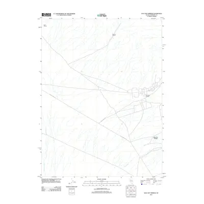
2011 Map of Kyle Hot Springs
USGS Topo · Published 2011About this map
Kyle Hot Springs sits at the foot of the Humboldt Range, marking a geothermal landmark in the high desert of Pershing County. This 2011 survey records a landscape where water is the primary sculptor, from the ephemeral flows of Phelps Creek and Buena Vista Creek to the thermal waters that gave the area its name. The terrain is deeply incised by dry drainages such as Reed Canyon, Harrison Canyon, and Klondike Canyon, which channel seasonal runoff from the higher elevations toward the valley floor. Transportation through this arid corridor relies on the established routes of Kyle Hot Springs Rd and Leach Canyon Rd, which provide the main access points across the alluvial fans. The map illustrates the isolated nature of these desert springs, which have long served as vital stops for travelers and locals alike in a region defined by its severe topography and limited water sources.
Find a feature on this map
8 named features on this map. Tap any name to fly to it.
Don’t see what you’re looking for? This feature index may not catch every label — zoom into the map to look around manually.
Map Details
Editions of this 2011 Kyle Hot Springs Map
This is the sole edition of this map. No revisions or reprints were ever made.
Other maps of this area

1931 · Lovelock
USGS Topo · 1:250,000

1932 · Sonoma Range
USGS Topo · 1:250,000

1935 · Lovelock
USGS Topo · 1:250,000

1939 · Sonoma Range
USGS Topo · 1:250,000

1954 · Unionville
USGS Topo · 1:62,500

1955 · Lovelock
USGS Topo · 1:250,000

1955 · Winnemucca
USGS Topo · 1:250,000

1956 · Imlay
USGS Topo · 1:62,500

1958 · Winnemucca
USGS Topo · 1:250,000

1959 · Lovelock
USGS Topo · 1:250,000