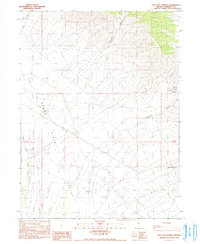
1990 Map of Kyle Hot Springs
USGS Topo · Published 1990About this map
Kyle Hot Springs sits at the eastern edge of the Buena Vista Valley, serving as a focal point for this arid Nevada landscape. The map illustrates a transition from the alluvial floor of the valley to the steep drainage systems of Reed Canyon and Harrison Canyon in the north. This region's economy is clearly defined by extraction, with several mining operations visible, including the Star Point Mine and an Open Pit Mine near the Klondike area. The presence of a Transmission Line cutting across the terrain and various Gravel Pits suggests the infrastructure required to support these remote industrial sites. Seasonal water drainage is captured through Buena Vista Creek, which flows through the valley floor, highlighting the importance of rare water sources in the high desert environment.
Find a feature on this map
12 named features on this map. Tap any name to fly to it.
Don’t see what you’re looking for? This feature index may not catch every label — zoom into the map to look around manually.
Map Details
Editions of this 1990 Kyle Hot Springs Map
This is the sole edition of this map. No revisions or reprints were ever made.
Other maps of this area

1931 · Lovelock
USGS Topo · 1:250,000

1932 · Sonoma Range
USGS Topo · 1:250,000

1935 · Lovelock
USGS Topo · 1:250,000

1939 · Sonoma Range
USGS Topo · 1:250,000

1954 · Unionville
USGS Topo · 1:62,500

1955 · Lovelock
USGS Topo · 1:250,000

1955 · Winnemucca
USGS Topo · 1:250,000

1956 · Imlay
USGS Topo · 1:62,500

1958 · Winnemucca
USGS Topo · 1:250,000

1959 · Lovelock
USGS Topo · 1:250,000