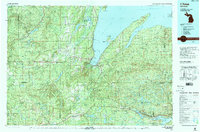
1991 Map of L'Anse
USGS Topo · Published 1991About this map
The southern shores of Keweenaw Bay anchor this 1991 landscape, where the primary settlements of L'Anse and Baraga face each other across L'Anse Bay. To the north, the Abbay e Peninsula extends into Lake Superior, creating the sheltered Huron Bay. The map highlights the region's diverse topography, including the Huron Mountains and the elevation at Mount Arvon, known as Michigan's highest point. Cultural and religious markers such as Presbytery Point and the village of Assinins suggest the area's deep community roots.
Find a feature on this map
126 named features on this map. Tap any name to fly to it.
Don’t see what you’re looking for? This feature index may not catch every label — zoom into the map to look around manually.
Map Details
Editions of this 1991 L'Anse Map
2 editions found
Other maps of this area

1895 · Ned Lake
USGS Topo · 1:62,500

1895 · Perch Lake
USGS Topo · 1:62,500

1899 · Witbeck
USGS Topo · 1:62,500

1915 · Houghton
USGS Topo · 1:62,500

1946 · Chassell
USGS Topo · 1:24,000

1946 · South Range
USGS Topo · 1:24,000

1948 · South Range
USGS Topo · 1:24,000

1948 · Chassell
USGS Topo · 1:24,000

1949 · Rockland
USGS Topo · 1:62,500

1950 · Greenland
USGS Topo · 1:62,500