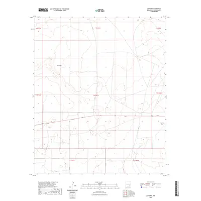
2023 Map of L E Ranch
USGS Topo · Published 2023About this map
Mesa Diablo rises prominently in this high-desert landscape, defining the northern geography of the area. This 2023 survey by the U.S. Geological Survey shows a network of rural roads and drainage patterns typical of southeastern New Mexico. Essential water sources for the cattle industry are represented by features like Red Lake Tank, while the natural hydrology is dictated by the Long Arroyo Draw and Long Arroyo. The map reveals a low-density settlement pattern marked by family or local names on secondary roads, including Lenore Rd, Janice Rd, and Donna Rd, which branch off from the more established E 2nd St corridor. This modern rendering of the L E Ranch quadrangle captures the enduring rural character of Chaves County, where land management is organized by a clear grid of township and range boundaries.
Find a feature on this map
21 named features on this map. Tap any name to fly to it.
Don’t see what you’re looking for? This feature index may not catch every label — zoom into the map to look around manually.
Map Details
Editions of this 2023 L E Ranch Map
This is the sole edition of this map. No revisions or reprints were ever made.
Other maps of this area

1949 · Sardine Mountain
USGS Topo · 1:24,000

1949 · Wade Ranch
USGS Topo · 1:24,000

1949 · Malstrom Ranch
USGS Topo · 1:24,000

1949 · L-E Ranch
USGS Topo · 1:24,000

1950 · Comanche Spring
USGS Topo · 1:24,000

1950 · Bottomless Lakes
USGS Topo · 1:24,000

1955 · Roswell
USGS Topo · 1:250,000

1958 · Roswell
USGS Topo · 1:250,000

1962 · Roswell
USGS Topo · 1:250,000

1962 · Acme
USGS Topo · 1:24,000