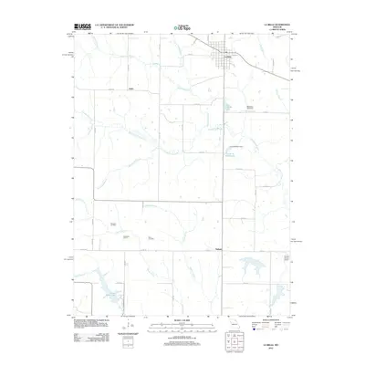
2012 Map of La Belle
USGS Topo · Published 2012About this map
The agricultural landscape of Lewis County unfolds across this 2012 survey, anchored by the town of La Belle at the intersection of Main St and 116th Ave. Smaller settlements and historical points of interest like Jeddo and Salem are connected by a grid of county roads, showing the enduring rural structure of the region. This geography is defined by a dendritic network of waterways, including Troublesome Creek and its many tributaries, which have shaped the local topography and placement of landmarks.
Find a feature on this map
51 named features on this map. Tap any name to fly to it.
Don’t see what you’re looking for? This feature index may not catch every label — zoom into the map to look around manually.
Map Details
Editions of this 2012 La Belle Map
This is the sole edition of this map. No revisions or reprints were ever made.
Other maps of this area

1903 · Kahoka
USGS Topo · 1:125,000

1903 · Palmyra
USGS Topo · 1:125,000

1903 · Edina
USGS Topo · 1:125,000

1948 · Quincy
USGS Topo · 1:250,000

1950 · Williamstown
USGS Topo · 1:24,000

1950 · Lewistown
USGS Topo · 1:24,000

1950 · La Belle
USGS Topo · 1:24,000

1951 · La Belle
USGS Topo · 1:24,000
1951 · Lewistown
USGS Topo · 1:24,000
1951 · Williamstown
USGS Topo · 1:24,000