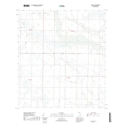
2018 Map of La Belle NW
USGS Topo · Published 2018About this map
Fisheating Creek and Rainey Slough dominate this section of Glades County, Florida, illustrating a landscape defined by slow-moving drainage systems and seasonal wetlands. The map detail reflects the transition of the South Florida interior, where natural watercourses like Chaparral Slough and Bee Br are intersected by a grid of rural infrastructure. Early 21st-century land management is visible through the network of county routes and access ways, including Co Rd 74 and Fire Tower Rd. The presence of Tasmania Rd and Farabee Rd suggests the historical naming of local corridors in an area largely dedicated to ranching or conservation. This documentation by the U.S. Geological Survey captures the hydrologic patterns and basic rural road network of the region prior to any significant modern intensification.
Find a feature on this map
14 named features on this map. Tap any name to fly to it.
Don’t see what you’re looking for? This feature index may not catch every label — zoom into the map to look around manually.
Map Details
Editions of this 2018 La Belle NW Map
This is the sole edition of this map. No revisions or reprints were ever made.
Other maps of this area

1956 · Telegraph Swamp NE
USGS Topo · 1:24,000

1956 · West Palm Beach
USGS Topo · 1:250,000

1956 · Fort Pierce
USGS Topo · 1:250,000

1957 · West Palm Beach
USGS Topo · 1:250,000

1957 · Long Island Marsh SE
USGS Topo · 1:24,000

1957 · Venus
USGS Topo · 1:24,000

1957 · Venus SW
USGS Topo · 1:24,000

1957 · Telegraph Swamp SE
USGS Topo · 1:24,000

1958 · Fort Pierce
USGS Topo · 1:250,000

1958 · West Palm Beach
USGS Topo · 1:250,000