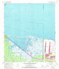
1967 Map of La Branche
USGS Topo · Published 1973About this map
Lake Pontchartrain dominates the northern half of this coastal landscape, where the southern shore transitions into the marshy reaches of St. Charles and Jefferson Parishes. The era's transportation and industrial footprint is heavy here, defined by the Illinois Central Gulf railroad cutting diagonally toward the growing suburban grid of Kenner. In this period, Kenner shows significant residential expansion north toward the Sea Wall, with street names like Loyola State and Tulane appearing near the New Orleans International Airport (Moisant Field). To the west, the landscape remains more industrial and natural, featuring the Oil and Gas Field near Good Hope and the intricate drainage network of Cross Bayou Canal. The Bonnet Carre Floodway stands as a massive civil engineering feature, protecting the region alongside smaller settlements like La Branche and Trepagnier.
Find a feature on this map
53 named features on this map. Tap any name to fly to it.
Don’t see what you’re looking for? This feature index may not catch every label — zoom into the map to look around manually.
Map Details
Editions of this 1967 La Branche Map
3 editions found
Other maps of this area

1891 · Hahnville
USGS Topo · 1:62,500

1891 · Spanish Fort
USGS Topo · 1:62,500

1891 · New Orleans
USGS Topo · 1:62,500

1892 · Bonnet Carre
USGS Topo · 1:62,500

1932 · New Orleans NW
USGS Topo · 1:31,680

1932 · Hahnville NW
USGS Topo · 1:31,680

1932 · Hahnville NE
USGS Topo · 1:31,680

1935 · Laplace
USGS Topo · 1:31,680

1935 · Luling
USGS Topo · 1:31,680

1936 · Hahnville
USGS Topo · 1:31,680