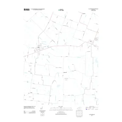
2013 Map of La Center
USGS Topo · Published 2013About this map
La Center serves as a central hub in this western Kentucky landscape, where the grid of the town is bordered by the winding course of Humphrey Cr and its associated Humphrey Slough. The region is defined by a dense network of country roads and family-named landmarks, reflecting generations of rural settlement. To the east, the community of Kevil sits near the intersection of several local routes, including Clarkline Rd E and Peyton Rd.
Find a feature on this map
104 named features on this map. Tap any name to fly to it.
Don’t see what you’re looking for? This feature index may not catch every label — zoom into the map to look around manually.
Map Details
Editions of this 2013 La Center Map
This is the sole edition of this map. No revisions or reprints were ever made.
Other maps of this area

1928 · La Center
USGS Topo · 1:62,500

1931 · Cairo
USGS Topo · 1:62,500

1932 · La Center
USGS Topo · 1:62,500

1933 · Cairo
USGS Topo · 1:62,500

1939 · Wickliffe
USGS Topo · 1:62,500

1939 · Cairo
USGS Topo · 1:62,500

1949 · Paducah
USGS Topo · 1:250,000

1950 · Paducah
USGS Topo · 1:250,000

1951 · Blandville
USGS Topo · 1:24,000

1951 · Wickliffe
USGS Topo · 1:24,000