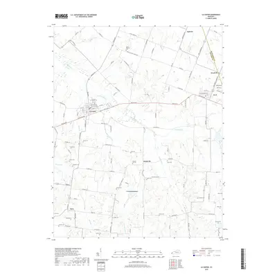
2019 Map of La Center
USGS Topo · Published 2019About this map
La Center serves as the primary hub in this western Kentucky landscape, situated near the headwaters of Humphrey Slough and Humphrey Cr. The map reveals a dense distribution of family and community burial grounds, such as Pleasant Hill Cem, Antioch Cem, and Terrell Cem, which are vital for genealogical research in Ballard County. Small settlements like Hinkleville and Slater anchor the southern reaches, while Ingleside and Woodville mark the northern and eastern fringes near the McCracken County line. The terrain is defined by a network of creeks, including Shawnee Cr and Little Humphrey Cr, which dictate the placement of local thoroughfares like Bandana Rd and Paducah Rd. This survey documents the persistent rural character of the region, where numerous church-affiliated sites like Mount Pleasant Cem continue to serve as focal points for the surrounding agricultural community.
Find a feature on this map
114 named features on this map. Tap any name to fly to it.
Don’t see what you’re looking for? This feature index may not catch every label — zoom into the map to look around manually.
Map Details
Editions of this 2019 La Center Map
This is the sole edition of this map. No revisions or reprints were ever made.
Other maps of this area

1928 · La Center
USGS Topo · 1:62,500

1931 · Cairo
USGS Topo · 1:62,500

1932 · La Center
USGS Topo · 1:62,500

1933 · Cairo
USGS Topo · 1:62,500

1939 · Wickliffe
USGS Topo · 1:62,500

1939 · Cairo
USGS Topo · 1:62,500

1949 · Paducah
USGS Topo · 1:250,000

1950 · Paducah
USGS Topo · 1:250,000

1951 · Blandville
USGS Topo · 1:24,000

1951 · Wickliffe
USGS Topo · 1:24,000