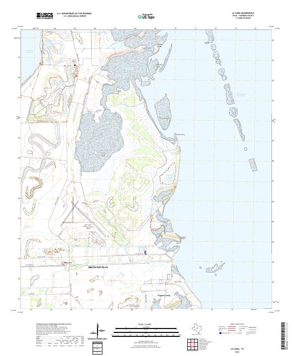
2022 Map of La Coma
USGS Topo · Published 2022About this map
Laguna Atascosa Refuge dominates the landscape of this Cameron County coastal survey, showcasing a complex network of wetlands and tidal flats along the Intracoastal Waterway. The terrain is defined by low-lying islands such as Gatlin Island and Gabrielson Island, alongside prominent points like Stover Point and Moranco Blanco. This environment supports a distinct trail system, including the Laguna Atascosa Loop Trl and Ocelot Rd, which navigate the marshy periphery of Laguna Atascosa.
Find a feature on this map
47 named features on this map. Tap any name to fly to it.
Don’t see what you’re looking for? This feature index may not catch every label — zoom into the map to look around manually.
Map Details
Editions of this 2022 La Coma Map
This is the sole edition of this map. No revisions or reprints were ever made.
Other maps of this area

1929 · La Coma
USGS Topo · 1:24,000

1929 · Point Isabel
USGS Topo · 1:24,000

1929 · Buena Vista
USGS Topo · 1:24,000

1929 · Laguna Vista
USGS Topo · 1:24,000

1930 · Padre Island No. 1
USGS Topo · 1:24,000

1930 · Los Fresnos
USGS Topo · 1:24,000

1930 · La Leona
USGS Topo · 1:24,000

1930 · Padre Island No. 2
USGS Topo · 1:24,000

1930 · Laguna Atascosa
USGS Topo · 1:24,000

1934 · Port Isabel
USGS Topo · 1:31,680