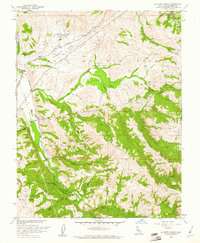
1960 Map of La Costa Valley
USGS Topo · Published 1961About this map
Vallecitos Atomic Laboratory stands as a prominent marker of mid-century scientific industry in this region of Alameda County. This 1960 revision documents a transition between historical land grants and emerging infrastructure, with the boundaries of the Valle de San Jose and Ex Mission San Jose defining the landscape. Water management and transportation networks are central to the area's development, illustrated by the Hetch Hetchy Aqueduct cutting across the terrain and the parallel routes of the Southern Pacific and Western Pacific railroads. The map captures the complex topography of the La Costa Valley, framed by Apperson Ridge and Waurab Ridge. From the small settlement at Scotts Corner to the US Veterans Administration facility near Arroyo Valle, the map provides a look at the rural character of the Sunol and Livermore areas before later suburban expansion.
Find a feature on this map
36 named features on this map. Tap any name to fly to it.
Don’t see what you’re looking for? This feature index may not catch every label — zoom into the map to look around manually.
Map Details
Editions of this 1960 La Costa Valley Map
4 editions found
Other maps of this area

1889 · San Jose
USGS Topo · 1:62,500

1897 · San Jose
USGS Topo · 1:62,500

1897 · Mt. Hamilton
USGS Topo · 1:62,500

1899 · San Jose
USGS Topo · 1:62,500

1906 · Pleasanton
USGS Topo · 1:62,500

1907 · Tesla
USGS Topo · 1:62,500

1941 · Pleasanton
USGS Topo · 1:62,500

1942 · Mt. Hamilton
USGS Topo · 1:62,500

1942 · Altamont
USGS Topo · 1:62,500

1943 · Pleasanton
USGS Topo · 1:62,500