2022 Map of La Crescent
USGS Topo · Published 2022About this map
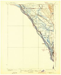
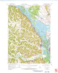
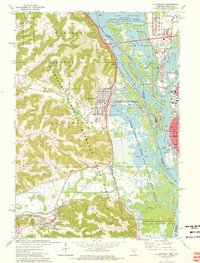
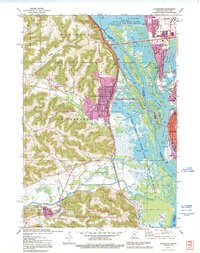
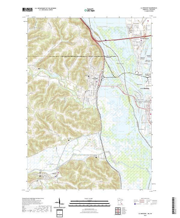
The Mississippi River and its intricate network of side channels like French Slough and Broken Arrow Slough dominate this landscape where Minnesota and Wisconsin meet. On the western bank, La Crescent sits at the foot of deep drainage valleys including Burns Valley and Pfeffer Valley, which cut through the high bluffs overlooking the river bottomlands. Across the water, the urban reach of La Crosse and its northern neighborhoods like French Island and West La Crosse show a dense grid of streets and industry tied to the river's path. To the south, the Root River joins the main stem near Hokah, a town marked by numerous local burial sites such as Mount Calvary Cem and the West Family Cem. This area serves as a critical transportation corridor, where the CP Rail line follows the riverbank, and recreational landmarks like Pettibone Beach provide public access to the historic waterfront.
Find a feature on this map
147 named features on this map. Tap any name to fly to it.
Don’t see what you’re looking for? This feature index may not catch every label — zoom into the map to look around manually.
Map Details
Editions of this 2022 La Crescent Map
This is the sole edition of this map. No revisions or reprints were ever made.
Historical Maps of Thunderbird Mobile Home Park Through Time
5 maps found