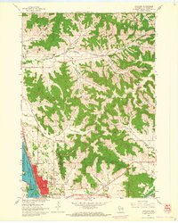
1963 Map of Onalaska
USGS Topo · Published 1964About this map
Lake Onalaska and the Black River define the western edge of this 1963 landscape, where the waters meet the Upper Mississippi River Wild Life and Fish Refuge. The terrain is characterized by a series of deeply etched coulees, including Long Coulee, Johnson Coulee, and Green Coulee, which dictate the placement of early rural infrastructure. Small agrarian clusters like Casberg and Sweden appear alongside a network of local education and faith-based landmarks, such as Maple Shade Sch and St Patricks Sch.
Find a feature on this map
41 named features on this map. Tap any name to fly to it.
Don’t see what you’re looking for? This feature index may not catch every label — zoom into the map to look around manually.
Map Details
Editions of this 1963 Onalaska Map
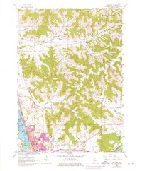
2 editions found
Other maps of this area

1926 · North Bend
USGS Topo · 1:62,500

1927 · La Crosse
USGS Topo · 1:62,500

1929 · Galesville
USGS Topo · 1:62,500

1929 · North Bend
USGS Topo · 1:62,500

1930 · La Crescent
USGS Topo · 1:62,500

1930 · La Crosse
USGS Topo · 1:62,500

1953 · Eau Claire
USGS Topo · 1:250,000

1956 · La Crescent
USGS Topo · 1:62,500

1958 · Eau Claire
USGS Topo · 1:250,000

1958 · La Crosse
USGS Topo · 1:250,000