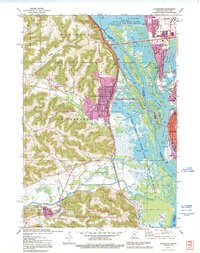
1991 Map of La Crescent
USGS Topo · Published 1995About this map
La Crosse and La Crescent anchor this detailed study of the river valley during the 1990s, where the Mississippi River creates a complex network of islands, sloughs, and backwaters. The landscape is defined by the sharp contrast between the high bluffs of the Richard J Dorer Memorial Hardwood State Forest and the vast marshlands of the Upper Mississippi River Wild Life and Fish Refuge.
Find a feature on this map
66 named features on this map. Tap any name to fly to it.
Don’t see what you’re looking for? This feature index may not catch every label — zoom into the map to look around manually.
Map Details
Editions of this 1991 La Crescent Map
This is the sole edition of this map. No revisions or reprints were ever made.
Other maps of this area

1926 · Stoddard
USGS Topo · 1:62,500

1927 · La Crosse
USGS Topo · 1:62,500

1930 · La Crescent
USGS Topo · 1:62,500

1930 · La Crosse
USGS Topo · 1:62,500

1956 · Brownsville
USGS Topo · 1:62,500

1956 · La Crescent
USGS Topo · 1:62,500

1958 · La Crosse
USGS Topo · 1:250,000

1961 · La Crosse
USGS Topo · 1:250,000
1963 · Onalaska
USGS Topo · 1:24,000
1963 · La Crosse
USGS Topo · 1:24,000