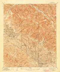
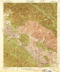
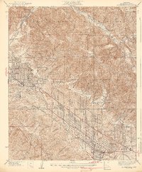
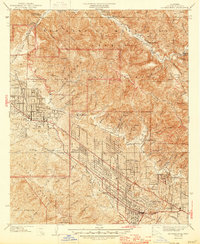
1939 Map of La Crescenta
USGS Topo · Published 1942About this map
The San Gabriel Mountains dominate the northern half of this Los Angeles County landscape, providing a stark contrast to the burgeoning valley developments of the late 1930s. The map captures a transitional moment for the Crescenta Valley, where the grid of La Crescenta and Montrose pushes up against the steep canyons. Significant local landmarks such as the Hillcrest Sanitarium and the Burbank YMCA Camp are visible, alongside established ranch lands like Big Tujunga Ranch and Ybarra Ranch.
Find a feature on this map
69 named features on this map. Tap any name to fly to it.
Don’t see what you’re looking for? This feature index may not catch every label — zoom into the map to look around manually.
Map Details
Editions of this 1939 La Crescenta Map
4 editions found
Other maps of this area

1894 · Los Angeles
USGS Topo · 1:62,500

1896 · Pasadena
USGS Topo · 1:62,500

1896 · Santa Monica
USGS Topo · 1:62,500

1898 · Santa Monica
USGS Topo · 1:62,500

1900 · Pasadena
USGS Topo · 1:62,500

1900 · Tujunga
USGS Topo · 1:62,500

1900 · Los Angeles
USGS Topo · 1:62,500

1900 · Fernando
USGS Topo · 1:62,500

1901 · Southern California Sheet No. 1
USGS Topo · 1:250,000

1902 · Santa Monica
USGS Topo · 1:62,500