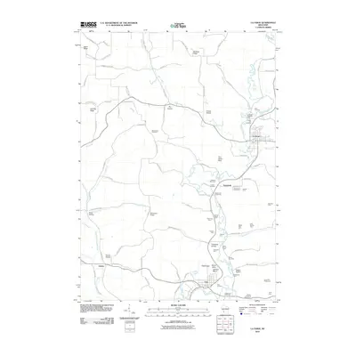
2010 Map of La Farge
USGS Topo · Published 2010About this map
The Kickapoo River valley serves as the primary geographic corridor through this section of Vernon County, anchoring settlements like La Farge and Viola. The landscape is defined by its agricultural heritage, with numerous named properties such as Meadow Stock Farm, Shady Lawn Stock Farm, and the Laurel Hill Sheep Farm dotting the hills and hollows. These family-named operations suggest a persistent pattern of rural life and land use that follows the winding path of the river and its tributaries, including the West Fork Kickapoo River and Otter Creek.
Find a feature on this map
99 named features on this map. Tap any name to fly to it.
Don’t see what you’re looking for? This feature index may not catch every label — zoom into the map to look around manually.
Map Details
Editions of this 2010 La Farge Map
This is the sole edition of this map. No revisions or reprints were ever made.
Other maps of this area

1923 · Viroqua
USGS Topo · 1:62,500

1924 · Gays Mills
USGS Topo · 1:62,500

1926 · Gays Mills
USGS Topo · 1:62,500

1926 · Viroqua
USGS Topo · 1:62,500

1926 · La Farge
USGS Topo · 1:62,500

1933 · Boaz
USGS Topo · 1:62,500

1958 · La Crosse
USGS Topo · 1:250,000

1961 · La Crosse
USGS Topo · 1:250,000

1965 · La Crosse
USGS Topo · 1:250,000

1965 · La Farge
USGS Topo · 1:62,500