2022 Map of La Farge
USGS Topo · Published 2022About this map
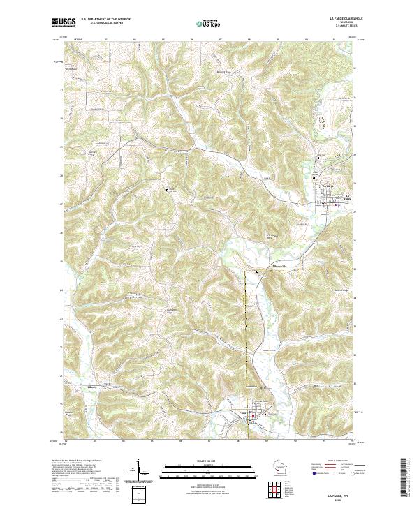
The Kickapoo River meanders through this portion of the Driftless Area, defining a landscape of narrow ridges and deep hollows. The village of La Farge sits at the northern end of this corridor, where Bear Cr and Otter Cr join the main river valley. Farther south, the settlement of Viola straddles the riverbanks, anchored by landmarks like Mt Nebo and Indianhead. The terrain is characterized by named ridges such as Salem Ridge and Fairview Ridge, which overlook agricultural land and small crossroads like Liberty. For genealogists and local historians, the map identifies several rural burying grounds including Lawton Cem near Tunnelville and the Star Cem to the east. The road network, including Bloomingdale Rd and Potter Ridge Rd, follows the natural contours of the highlands, connecting isolated homesteads and ridges to the valley floor.
Find a feature on this map
123 named features on this map. Tap any name to fly to it.
Don’t see what you’re looking for? This feature index may not catch every label — zoom into the map to look around manually.
Map Details
Editions of this 2022 La Farge Map
This is the sole edition of this map. No revisions or reprints were ever made.
Historical Maps of Forest Through Time
4 maps found