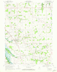
1969 Map of La Fontaine
USGS Topo · Published 1972About this map
La Fontaine serves as the primary hub of this landscape at the junction of Wabash and Grant counties, where the Penn Central line cuts a diagonal path through the countryside. This 1969 field-checked survey reveals a territory defined by its water management and agricultural roots, bounded by the controlled inundation areas of the Salamonie Reservoir in the northeast and the Mississinewa Reservoir in the southwest. The map is particularly valuable for genealogists, documenting numerous small family and community burial grounds such as Stone Cem, Waggoner Cem, and Hale Cem scattered across the townships of Noble, Lagro, and Liberty. These sites, along with features like Oil Wells and Sewage Disposal Ponds, reflect the practical infrastructure and historical land use of rural Indiana during the late 1960s.
Find a feature on this map
32 named features on this map. Tap any name to fly to it.
Don’t see what you’re looking for? This feature index may not catch every label — zoom into the map to look around manually.
Map Details
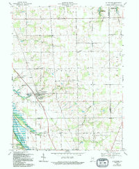
Editions of this 1969 La Fontaine Map
2 editions found
Other maps of this area

1950 · Lagro
USGS Topo · 1:24,000

1950 · Andrews
USGS Topo · 1:24,000

1950 · Mount Etna
USGS Topo · 1:24,000

1951 · Mount Etna
USGS Topo · 1:24,000

1951 · Andrews
USGS Topo · 1:24,000

1951 · Lagro
USGS Topo · 1:24,000

1952 · Wabash
USGS Topo · 1:24,000

1953 · La Fontaine
USGS Topo · 1:24,000

1953 · Somerset
USGS Topo · 1:24,000

1953 · Muncie
USGS Topo · 1:250,000