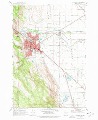
1963 Map of La Grande SE
USGS Topo · Published 1977About this map
La Grande serves as the focal point of this 1963 survey, illustrating the city's mid-century expansion between the steep slopes of Rooster Peak and the sprawling floor of the Grande Ronde Valley. The map captures the institutional core of the community, featuring the campus of Eastern Oregon College and several local schools like Riveria Sch and Central Sch. The infrastructure of the era is well-defined, from the Union Pacific rail corridor and Pacific Highway to the La Grande Municipal Airport on the eastern edge. Beyond the city limits, the landscape transitions into a complex network of waterways, including the Grande Ronde River and numerous sloughs such as McAlister Slough and Gekeler Slough. To the south, the Ladd Marsh Game Management Area highlights the preserved wetlands that contrast with the organized grid of Island City and the surrounding agricultural tracts.
Find a feature on this map
67 named features on this map. Tap any name to fly to it.
Don’t see what you’re looking for? This feature index may not catch every label — zoom into the map to look around manually.
Map Details
Editions of this 1963 La Grande SE Map
2 editions found
Other maps of this area

1906 · Telocaset
USGS Topo · 1:125,000

1953 · Pendleton
USGS Topo · 1:250,000

1955 · Grangeville
USGS Topo · 1:250,000

1956 · Pendleton
USGS Topo · 1:250,000

1959 · Grangeville
USGS Topo · 1:250,000

1963 · La Grande SE
USGS Topo · 1:24,000

1963 · Hilgard
USGS Topo · 1:24,000

1963 · Summerville
USGS Topo · 1:24,000

1964 · Drumhill Ridge
USGS Topo · 1:24,000

1965 · Conley
USGS Topo · 1:24,000