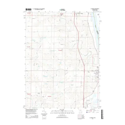
2015 Map of La Grange
USGS Topo · Published 2015About this map
The Mississippi River defines the eastern boundary of this Lewis County landscape, where the town of La Grange sits at the water's edge. This modern topographic record captures the transition from the riverbanks to the rolling interior, where the Wyaconda River and Durgens Cr carve drainage patterns toward the larger valley. The map is notable for its documentation of water management and local land use, featuring numerous man-made bodies of water like Durgens Cr Watershed Lake Number 4 and Scott Shaffer Lake Number 7. Small rural clusters such as Weber and Dover are shown alongside established centers like Canton. Genealogists will find several burial grounds noted, including Riverview Cemetery and the Salter Cemetery near the river bluffs, providing specific geographic context for families tied to these historic river communities.
Find a feature on this map
60 named features on this map. Tap any name to fly to it.
Don’t see what you’re looking for? This feature index may not catch every label — zoom into the map to look around manually.
Map Details
Editions of this 2015 La Grange Map
This is the sole edition of this map. No revisions or reprints were ever made.
Other maps of this area

1903 · Kahoka
USGS Topo · 1:125,000

1903 · Palmyra
USGS Topo · 1:125,000

1925 · Quincy
USGS Topo · 1:62,500

1944 · Quincy
USGS Topo · 1:62,500

1945 · Quincy
USGS Topo · 1:62,500

1946 · Mendon
USGS Topo · 1:62,500

1948 · Quincy
USGS Topo · 1:250,000

1948 · Mendon
USGS Topo · 1:62,500

1949 · Durham
USGS Topo · 1:24,000

1949 · Maywood
USGS Topo · 1:24,000