
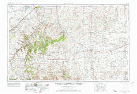
1955 Map of La Junta
USGS Topo · Published 1966About this map
La Junta stands as a primary railroad hub at the northern edge of this high plains landscape, where the Atchison Topeka and Santa Fe line follows the Arkansas River corridor. The geography transitions from irrigated valley lands near the Catlin Canal and Otero Canal into the dry, high-altitude cattle country of the south. Evidence of the early Cold War era appears near the western edge with a Bomb target (abandoned) located on the prairie.
Find a feature on this map
62 named features on this map. Tap any name to fly to it.
Don’t see what you’re looking for? This feature index may not catch every label — zoom into the map to look around manually.
Map Details
Editions of this 1955 La Junta Map
3 editions found
Other maps of this area

1890 · Granada
USGS Topo · 1:125,000

1891 · Catlin
USGS Topo · 1:125,000

1891 · Albany
USGS Topo · 1:125,000

1891 · Higbee
USGS Topo · 1:125,000

1891 · Las Animas
USGS Topo · 1:125,000

1891 · Timpas
USGS Topo · 1:125,000

1891 · Nepesta
USGS Topo · 1:125,000

1891 · Apishapa
USGS Topo · 1:125,000

1891 · Springfield
USGS Topo · 1:125,000

1891 · Mesa De Maya
USGS Topo · 1:125,000