
1958 Map of La Junta
USGS Topo · Published 1958About this map
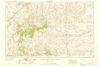
La Junta stands as the primary hub of this high plains region, situated where the Atchison Topeka and Santa Fe railroad tracks meet the Arkansas River. This 1958 edition details a landscape defined by an extensive network of ranching and early water management, visible in the dozens of windmills and the complex irrigation systems of the Catlin Canal and Otero Canal. To the south, the dramatic rise of the Mesa De Maya and Carrizo Mountain breaks the horizontal expanse of the plains, while the eastern portion of the map transitions into the Kansas borderlands. Local history and genealogical markers are scattered throughout the agricultural landscape, including the Minneapolis Cemetery, the Lycan Post Office, and rural schoolhouses like Sunderland School. A notable relic of the era's military activity appears northwest of town at the bomb target (abandoned).
Find a feature on this map
91 named features on this map. Tap any name to fly to it.
Don’t see what you’re looking for? This feature index may not catch every label — zoom into the map to look around manually.
Map Details
Editions of this 1958 La Junta Map
2 editions found
Other maps of this area

1890 · Granada
USGS Topo · 1:125,000

1891 · Catlin
USGS Topo · 1:125,000

1891 · Albany
USGS Topo · 1:125,000

1891 · Higbee
USGS Topo · 1:125,000

1891 · Las Animas
USGS Topo · 1:125,000

1891 · Timpas
USGS Topo · 1:125,000

1891 · Nepesta
USGS Topo · 1:125,000

1891 · Apishapa
USGS Topo · 1:125,000

1891 · Springfield
USGS Topo · 1:125,000

1891 · Mesa De Maya
USGS Topo · 1:125,000