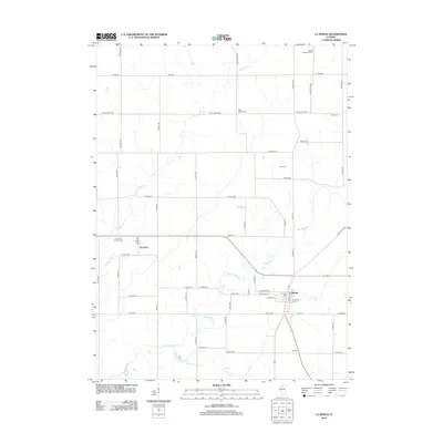
2012 Map of La Moille
USGS Topo · Published 2012About this map
La Moille and Van Orin anchor this portrait of north-central Illinois, where the landscape is defined by a rigorous grid of section-line roads and the winding paths of several waterways. Big Bureau Cr meanders across the southern half of the map, joined by the tributaries Masters Fork and Pike Cr. This 2012 survey illustrates the enduring agricultural character of the region, where numerous small burial grounds serve as quiet markers of early settlement and genealogy. Significant family-named sites include Baird Pumphrey Cem, Theiss Cem, and Greenfield Cem near the town center of La Moille. The network of county roads, such as Van Orin Rd and Old Chicago Rd, connects these rural communities, while the path of W Railroad St hints at the transportation corridors that historically facilitated the movement of local grain and goods.
Find a feature on this map
53 named features on this map. Tap any name to fly to it.
Don’t see what you’re looking for? This feature index may not catch every label — zoom into the map to look around manually.
Map Details
Editions of this 2012 La Moille Map
This is the sole edition of this map. No revisions or reprints were ever made.
Other maps of this area

1893 · Hennepin
USGS Topo · 1:62,500

1893 · Lasalle
USGS Topo · 1:62,500

1909 · Hennepin
USGS Topo · 1:62,500

1911 · La Salle
USGS Topo · 1:62,500

1911 · Hennepin
USGS Topo · 1:62,500

1913 · La Salle
USGS Topo · 1:62,500

1947 · La Salle
USGS Topo · 1:62,500

1951 · Amboy
USGS Topo · 1:62,500

1952 · Mendota
USGS Topo · 1:62,500

1958 · Aurora
USGS Topo · 1:250,000