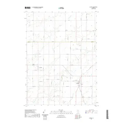
2021 Map of La Moille
USGS Topo · Published 2021About this map
Agricultural patterns and small-town grids define this portion of the Illinois prairie, situated along the border of Lee and Bureau counties. The village of La Moille serves as a central hub, where streets like W High St and Martin St are arranged near Greenfield Cem. To the northwest, the smaller settlement of Van Orin is anchored by the Van Orin Repose Cem and connected by 2750 North Ave.
Find a feature on this map
36 named features on this map. Tap any name to fly to it.
Don’t see what you’re looking for? This feature index may not catch every label — zoom into the map to look around manually.
Map Details
Editions of this 2021 La Moille Map
This is the sole edition of this map. No revisions or reprints were ever made.
Other maps of this area

1893 · Hennepin
USGS Topo · 1:62,500

1893 · Lasalle
USGS Topo · 1:62,500

1909 · Hennepin
USGS Topo · 1:62,500

1911 · La Salle
USGS Topo · 1:62,500

1911 · Hennepin
USGS Topo · 1:62,500

1913 · La Salle
USGS Topo · 1:62,500

1947 · La Salle
USGS Topo · 1:62,500

1951 · Amboy
USGS Topo · 1:62,500

1952 · Mendota
USGS Topo · 1:62,500

1958 · Aurora
USGS Topo · 1:250,000