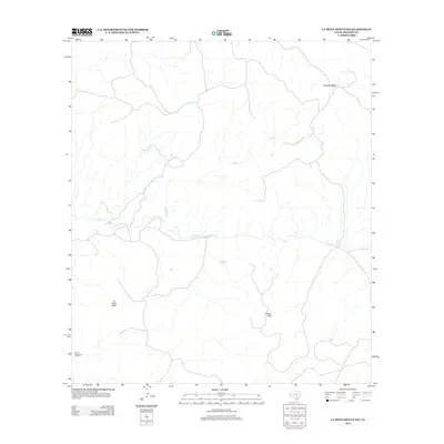
2012 Map of La Mota Mountain
USGS Topo · Published 2012About this map
La Mota Mtn and the adjacent Alazan Hills define the high-desert landscape of Presidio County in this 2012 survey. This region is characterized by significant topographic variation, where the elevation drops from the broad Tascotal Mesa into the deeply incised drainage of Lava Canyon. Water remains the central organizing principle for this arid environment, with the seasonal flow of Terneros Cr and Navajo Cr carving paths through the rocky terrain. A vital permanent water source is marked at Alazan Spring, a feature that has historically influenced land use and movement through this part of West Texas. The map illustrates a largely undeveloped expanse, showcasing the complex natural drainage systems and landforms that dictate the character of the Big Bend region.
Find a feature on this map
7 named features on this map. Tap any name to fly to it.
Don’t see what you’re looking for? This feature index may not catch every label — zoom into the map to look around manually.
Map Details
Editions of this 2012 La Mota Mountain Map
This is the sole edition of this map. No revisions or reprints were ever made.
Other maps of this area

1896 · Polvo
USGS Topo · 1:125,000

1896 · Shafter
USGS Topo · 1:125,000

1903 · Terlingua
USGS Topo · 1:125,000

1904 · Terlingua
USGS Topo · 1:125,000

1917 · Tascotal Mesa
USGS Topo · 1:62,500

1931 · Lajitas
USGS Topo · 1:62,500

1944 · Tascotal Mesa
USGS Topo · 1:62,500

1959 · Emory Peak
USGS Topo · 1:250,000

1959 · Presidio
USGS Topo · 1:250,000

1965 · Presidio
USGS Topo · 1:250,000