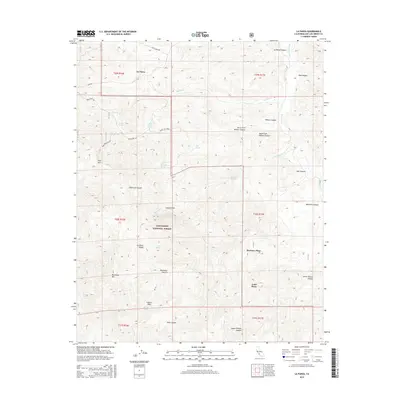
2015 Map of La Panza
USGS Topo · Published 2015About this map
La Panza sits at the heart of this high-elevation landscape in eastern San Luis Obispo County, where the topography is defined by the La Panza Range and the prominent peak of Machesna Mtn. This survey captures the rural character of the region within the Los Padres National Forest, where water sources like King David Spring and Coyote Hole dictate the locations of remote outposts. Settlement patterns are sparse, represented by named homesteads such as Martinez Place and Todd Place. The map details a network of canyons, including American Canyon and Willow Canyon, which feed into San Juan Creek. Navigation through this backcountry is shown via forest routes and ranch roads like Lewis Ranch Rd and Pozo Rd, which serve the various potreros and springs that have sustained ranching and forest activities in the area for generations.
Find a feature on this map
43 named features on this map. Tap any name to fly to it.
Don’t see what you’re looking for? This feature index may not catch every label — zoom into the map to look around manually.
Map Details
Editions of this 2015 La Panza Map
This is the sole edition of this map. No revisions or reprints were ever made.
Other maps of this area

1922 · Pozo
USGS Topo · 1:62,500

1922 · Nipomo
USGS Topo · 1:62,500

1932 · La Panza
USGS Topo · 1:48,000

1935 · La Panza
USGS Topo · 1:62,500

1936 · La Panza
USGS Topo · 1:62,500

1937 · Branch Mtn
USGS Topo · 1:48,000

1942 · Branch Mountain
USGS Topo · 1:62,500

1947 · San Luis Obispo
USGS Topo · 1:250,000

1948 · San Luis Obispo
USGS Topo · 1:250,000
1952 · La Panza
USGS Topo · 1:62,500