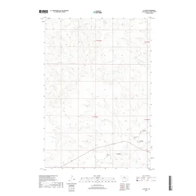
2017 Map of La Plant
USGS Topo · Published 2017About this map
La Plant serves as the central settlement in this Dewey County landscape, situated where the high plains meet a network of seasonal watercourses. The area is defined by its deep cultural and spiritual roots, evidenced by several scattered burial grounds including Rushs Enemy Cem and the Saint Pauls Episcopal Cem. These sites, along with the Saint Marys Catholic Cem, reflect the community's established history along the Laplant Rd corridor.
Find a feature on this map
17 named features on this map. Tap any name to fly to it.
Don’t see what you’re looking for? This feature index may not catch every label — zoom into the map to look around manually.
Map Details
Editions of this 2017 La Plant Map
This is the sole edition of this map. No revisions or reprints were ever made.
Other maps of this area

1951 · Virginia
USGS Topo · 1:24,000

1951 · Ridgeview NE
USGS Topo · 1:24,000

1951 · La Plant
USGS Topo · 1:24,000

1951 · Promise
USGS Topo · 1:24,000

1952 · Trail City SW
USGS Topo · 1:24,000

1952 · Glencross SE
USGS Topo · 1:24,000

1953 · McIntosh
USGS Topo · 1:250,000

1958 · McIntosh
USGS Topo · 1:250,000
1981 · Stove Creek
USGS Topo · 1:24,000
1981 · La Plant SW
USGS Topo · 1:24,000