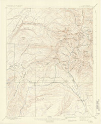
1908 Map of La Plata
USGS Topo · Published 1937About this map
The Rio Grande Southern R. R. carves through the southern reaches of the La Plata Mountains, providing a vital link for the mining operations and ranching outposts that defined this region at the turn of the century. Settlements like Hesperus and Parrott are depicted as focal points of activity, while Menefee Ranch and Thompson Park indicate the agricultural life established in the lower valleys.
Find a feature on this map
91 named features on this map. Tap any name to fly to it.
Don’t see what you’re looking for? This feature index may not catch every label — zoom into the map to look around manually.
Map Details
Editions of this 1908 La Plata Map
3 editions found
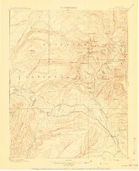

Other maps of this area

1895 · La Plata
USGS Topo · 1:62,500

1897 · La Plata
USGS Topo · 1:62,500

1897 · Rico
USGS Topo · 1:62,500

1898 · Durango
USGS Topo · 1:62,500

1898 · Engineer Mountain
USGS Topo · 1:62,500

1898 · Rico
USGS Topo · 1:62,500

1899 · La Plata
USGS Topo · 1:62,500
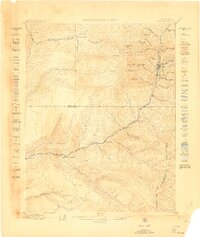
1899 · Rico
USGS Topo · 1:62,500

1900 · Engineer Mountain
USGS Topo · 1:62,500
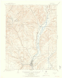
1907 · Durango
USGS Topo · 1:62,500